Highlights van Gambia


World Heritage Sites
- James Island en omgeving
- Steencirkels van Senegambia

Typisch
| nationale gerechten | Domoda |
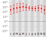
Klimaat
| Kenmerken |
|
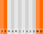
| Temperatuur | Beste tijd voor een reis |
|
|
Typisch
| Officiële landsnaam | Republiek Gambia |
| Hoofdstad | Banjul |
| Nationaliteit | Gambiaan |
| Talen | engels |
| Visum nodig? | Nee |
| Munteenheid | Dalasi (GMD) |
| Regeringsvorm | republiek |
| Grootte t.o.v. Nederland | 3.7 keer kleiner |
| Bevolking | 1.7 miljoen |
| Bevolkingsdichtheid t.o.v. Nederland | 2.6 keer lager |
| Laagste punt | 0 m |
| Hoogste punt | 53 m |
Low-cost airlines
- Arke Fly
Exotische ziekten
- malaria
- hepatitis A
- typhus
- dengue
- gele koorts
Interessante boeken over Gambia
-
Reisgids Landenreeks Senegal en Gambia | KIT Publishers | 14.50 €
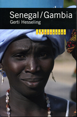
Verzameling artikelen over de toestand van het land. Echt iets voor iemand die meer over het land wil weten. Niet direct een reisgids, maar meer een j... meer
Verzameling artikelen over de toestand van het land. Echt iets voor iemand die meer over het land wil weten. Niet direct een reisgids, maar meer een journalistiek overzicht.
-
Natuurgids - Vogelgids Birds of Senegal and The Gambia | Helm Fiels Guides | 38.95 €
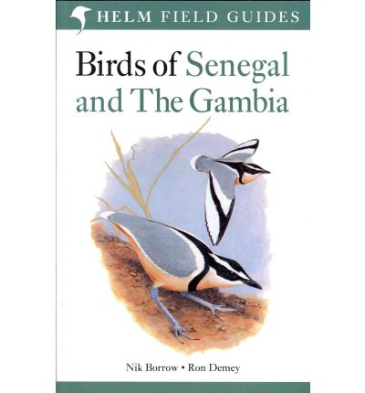
Fantastische vogelgids voor deze paradijslijke vogellanden. Veel informatie, goede tekeningen. Enig nadeel is het vrij grote formaat. The Gambia i... meer
Fantastische vogelgids voor deze paradijslijke vogellanden. Veel informatie, goede tekeningen. Enig nadeel is het vrij grote formaat.
The Gambia is a top birding destination, combining a terrific diversity and concentration of species with a good tourist infrastructure. It is the perfect introduction to African birding. Numerous regional specialities guarantee enduring popularity with more experienced 'world-listers'. This is the standard field guide to one of the world's most popular and impressive birding regions. It is illustrated with 48 stunning colour plates, depicting each species in all its plumages. These plates are supplemented by useful line drawings and figures. The concise text has been exhaustively researched, and reflects the considerable field experience of the authors. It includes essential information on field identification, as well as voice, behaviour, habitat and distribution. The introduction provides an overview of the region's history, geography and ecology. The clear layout and practical format make this book ideal for use in the field.

Vakantiebestemmingen met vergelijkbare kenmerkenMisschien bent u ook geïnteresseerd in andere vakantielanden met de volgende kenmerken: |
Reis en Vakantie Top 10Gambia is vertegenwoordigd in de volgende reis top10's: |

- © 2010-2015 top10gezien.nl
- over deze site
- disclaimer
- adverteren
- contact