Highlights van Ivoorkust
Natuur
- Mount Nimba - prachtig landschap van heuvels en steile afgronden


World Heritage Sites
- Natuurreservaat Mount Nimba
- Nationaal park Taï
- Nationaal park Comoé

Typisch
| nationale gerechten | Maquis |
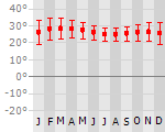
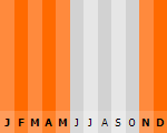
Klimaat
| Kenmerken |
|
| Temperatuur | Beste tijd voor een reis |
|
|
Typisch
| Officiële landsnaam | Republiek Ivoorkust |
| Hoofdstad | Abidjan |
| Nationaliteit | Ivoriaan |
| Talen | frans |
| Visum nodig? | Ja |
| Munteenheid | Afrikaanse Franc (XOF) |
| Regeringsvorm | republiek |
| Grootte t.o.v. Nederland | 7.8 keer groter |
| Bevolking | 18.4 miljoen |
| Bevolkingsdichtheid t.o.v. Nederland | 7.0 keer lager |
| Laagste punt | 0 m |
| Hoogste punt | 1752 m |
Exotische ziekten
- malaria
- hepatitis A
- typhus
- gele koorts
Interessante boeken over Ivoorkust
-
Wegenkaart - landkaart Ivoorkust / Ivory Coast | Michelin 747 | 9.50 €
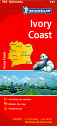
The Michelin National road map of Ivory Coast at 1:800,000 scale is ideal for trip & route planning. The map gives comprehensive covera... meer
The Michelin National road map of Ivory Coast at 1:800,000 scale is ideal for trip & route planning. The map gives comprehensive coverage of national road networks showing all major motorways and main roads, and good coverage of unsurfaced roads, recognized tracks & shows a good deal of road surface type & quality information. The map is divided by grid showing latitude and longitude. Good coverage of smaller towns and settlements.Distances between major locations are marked along roads, with both total distance and several intermediate distances shown. A quick-reference chart of regional temperature & rainfall data is included, cross referenced to locations on the map. The map also includes a short textual description of the country’s climate, history, geography, economy and core statistics. The map is not indexed.Clear, easy-to read cartography shows roads in reds, yellows and white with black outlines. No topographical data is shown except some spot heights. Woodland & forest is marked with green shading. Built-up urban areas are shaded beige/brown. Airports, airfields & railways are marked. National and administrative region boundaries are clearly highlighted, as are national park boundaries.Tourist information includes:- Places of particular tourist interest- Scenic driving routes- Viewpoints & panoramas- Hotel-Restaurants, some with fuel/repair facilities- Tourist complexes/resorts & secluded hotels, camping sites & safari lodgesTown plans & regional enlargements:- Abidjan region at 1:100,000 & Abidjan centre at 1:60,000 -
Wegenkaart Ivoorkust - Cote d'Ivoire | IGN | 11.75 €
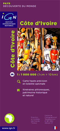
Goede wegenkaart Ivoorkust / Cote d'voire van het Franse Cartografisch Instituut. Met autoroutes en stadsplattegronden van de belangrijkste sted... meer
Goede wegenkaart Ivoorkust / Cote d'voire van het Franse Cartografisch Instituut. Met autoroutes en stadsplattegronden van de belangrijkste steden.
Vakantiebestemmingen met vergelijkbare kenmerkenMisschien bent u ook geïnteresseerd in andere vakantielanden met de volgende kenmerken: |
Reis en Vakantie Top 10Ivoorkust is vertegenwoordigd in de volgende reis top10's: |

- © 2010-2015 top10gezien.nl
- over deze site
- disclaimer
- adverteren
- contact