Highlights van Zuid-Amerika
Typisch
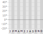
Klimaat
| Temperatuur | Beste tijd voor een reis |
|
|
Typisch
| Officiële landsnaam | Zuid-Amerika |
Interessante boeken over Zuid-Amerika
-
Woordenboek Taalgids Brazilian Portugese Phrasebook - Braziliaans Portugees | Lonely Planet | 7.25 €
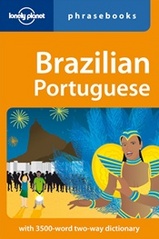
Handzame taalgids met zowel zinnen, idioom en woorden. Engels - Braziliaans en omgekeerd. Lonely Planet
Handzame taalgids met zowel zinnen, idioom en woorden. Engels - Braziliaans en omgekeerd. Lonely Planet
-
Reisverhaal The Robber of Memories | Michael Jacobs | Michael Jacobs 14.95 €
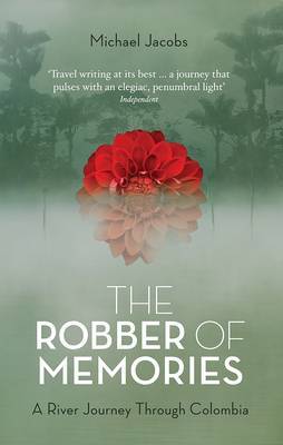
A gripping journey up the River Magdalena into the centre of Colombia, and a deeply personal meditation on memory and loss in the footsteps of Gabri... meer
A gripping journey up the River Magdalena into the centre of Colombia, and a deeply personal meditation on memory and loss in the footsteps of Gabriel Garcia Marquez.
Running through the heart of Colombia is a river emblematic of the fascination and tragedy of South America, the Magdalena. Considered by some to be the most dangerous place in the world, travellers along the river - for centuries the only route into the vast South American interior - were at the mercy of tropical disease, dangerous animals and precarious barges. A third of the victims of 'la violencia', Colombia's period of civil conflict which began in the 1950s, ended up in its waters. Townships alongside it have experienced some of the worst massacres in South American history. In 2011, Michael Jacobs travelled its whole length to the river's source high up in Andean moorlands controlled by guerrillas. In spellbinding prose, he charts the dangers he negotiated - including a terrifying three day encounter with the FARC - while uncovering the river's history of pioneering explorations, environmental decline and political violence. As Jacobs delves into the history of destruction and decay along the river, he also makes a deeply personal exploration into memory and its loss: not far from the river's banks lies a group of townships with the highest incidence of early onset Alzheimer's in the world. Jacobs reflects on the lives of his father, and his mother - sufferers respectively from Alzheimer's and dementia - as he travels upstream towards what comes to seem like a heartland of mystery, magic and darkness.
Vakantiebestemmingen met vergelijkbare kenmerkenMisschien bent u ook geïnteresseerd in andere vakantielanden met de volgende kenmerken: |
Reis en Vakantie Top 10Zuid-Amerika is vertegenwoordigd in de volgende reis top10's: |
Bestemmingen in Zuid-Amerika

- © 2010-2015 top10gezien.nl
- over deze site
- disclaimer
- adverteren
- contact